| Croft Weather | |||
|---|---|---|---|
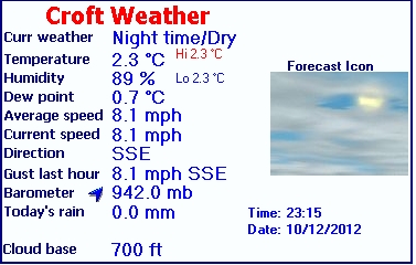
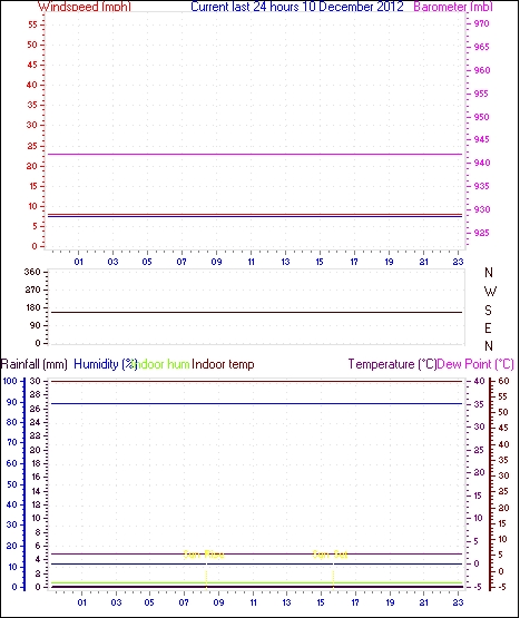
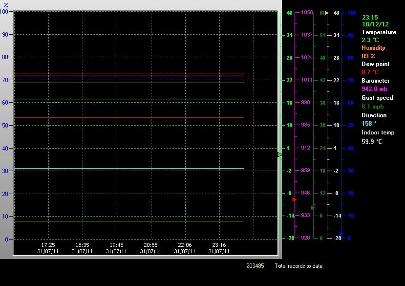
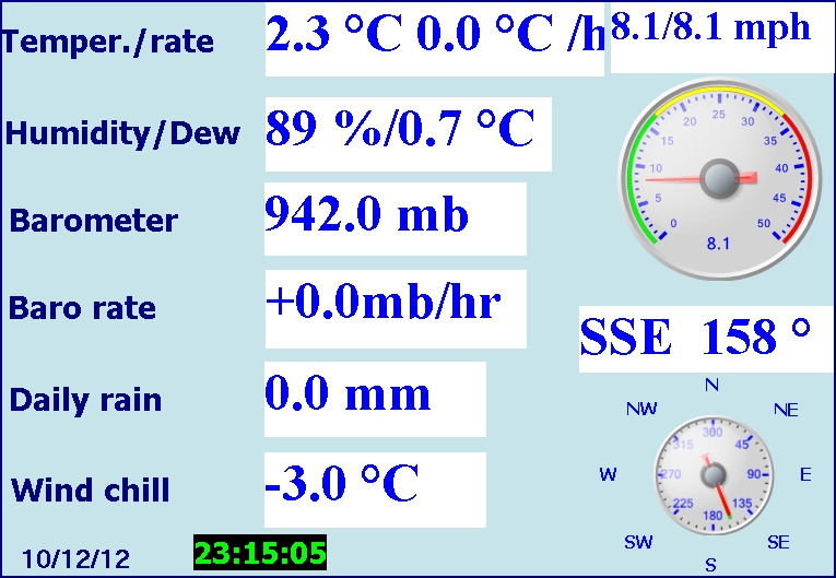
| LAST READING AT TIME: 23:15 DATE: 10 December 2012, time of next update: 23:30 | |||
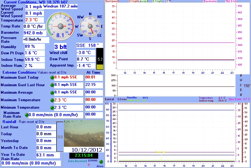
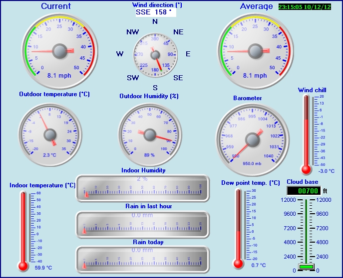
| Current Weather | Night time/Dry | Current Temperature | 2.3°C (36.1°F), Apparent temp -1.4°C |
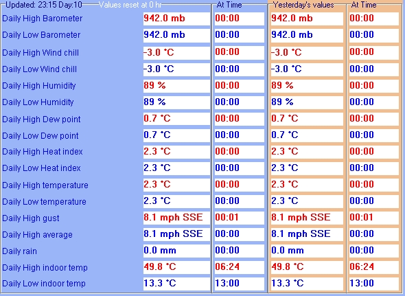
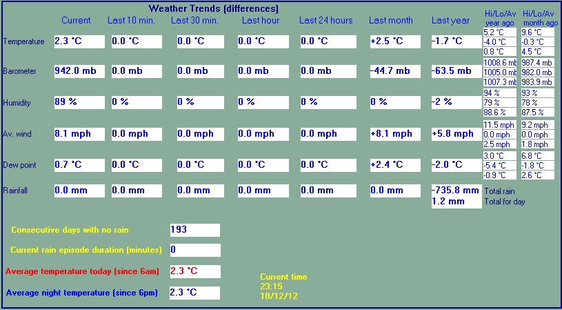
| Maximum Temperature (since midnight) | 2.3°C at: 00:00 | Minimum Temperature (since midnight) | 2.3°C at: 00:00 |
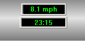
| Average windspeed (ten minute) | 8.1 mph | Wind Direction (ten minute) | SSE (158°) |
| Windchill Temperature | -3.0°C | Maximum Gust (last hour) | 8.1 mph at: 22:15 |
| Maximum Gust (since midnight) | 8.1 mph at: 00:01 | Maximum 1 minute average (since midnight) | 8.1 mph at: 00:00 |
| Rainfall (last hour) | 0.0 mm | Rainfall (since midnight) | 0.0 mm (0.00 in.)--- |
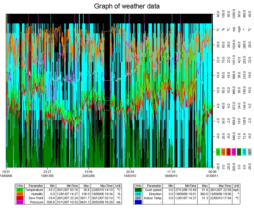
| Rainfall This month | 0.0 mm (0.00 in.) | Rainfall To date this year | 63.1 mm (2.48 in.) |
| Maximum rain per minute (last hour) | 0.0 mm/min | Maximum rain per hour (last 6 hours) | 0.0 mm/hour |
| Yesterdays rainfall | 0.0 mm | DewPoint | 0.7°C (Wet Bulb :1.7°C ) |
| Humidity | 89 %, Humidex 0.3°C | Barometer corrected to msl | 942.0 mb |
| Pressure change | 0.0 mb (last hour) | Trend (last hour) | STEADY |
| Pressure change (last 12 hours) | +0.0 mb | Pressure change (last 6 hours) | +0.0 mb |
| Lightning counts 0 since noon | |||
| Time of last strike | 08:20:47 2005/07/21 | Counts in the last 30 minutes | 0 |
Use the RELOAD facility on your browser to retrieve the latest data.